Jacksonville is forecast to reach 101°F by Tuesday, June 23, marking the most extreme temperature in this forecast period, according to National Weather Service data. That reading, combined with Orlando’s projected 99°F high on Monday, June 22, creates a 24-hour heat surge across Florida’s interior and northeast corridor that stands as the week’s dominant weather story.
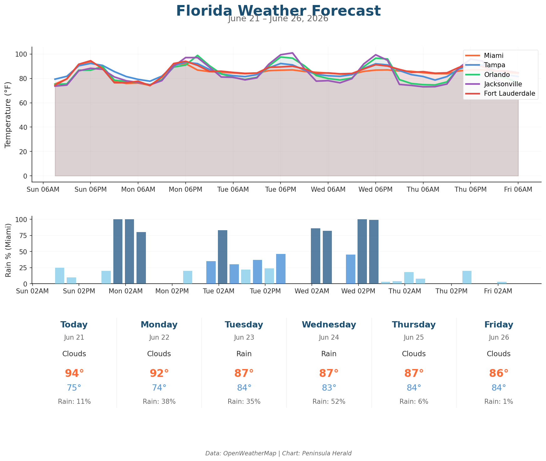
Today, Miami leads South Florida with a 94°F high and a low of 75°F, with only an 11% rain chance and winds up to 13 mph. Tampa reaches 92°F with a 79°F low, zero rain chance, and 61% humidity. Orlando hits 90°F today with a 20% rain chance and 4.3mm of precipitation already in the forecast. Jacksonville sits at 88°F with a 74°F low, 64% humidity, and no rain expected.
Orlando climbs from 90°F today to 99°F Monday before pulling back to 98°F Tuesday and 97°F Wednesday. Jacksonville surges from 88°F today to 97°F Monday, then peaks at 101°F Tuesday with gusts reaching 19 mph. Miami cools from 94°F today to 92°F Monday, then drops sharply to 87°F Tuesday as rain chances jump to 35%. Tampa holds at 92°F through Tuesday before easing to 87°F by Friday, June 26, when a 7% rain chance returns.