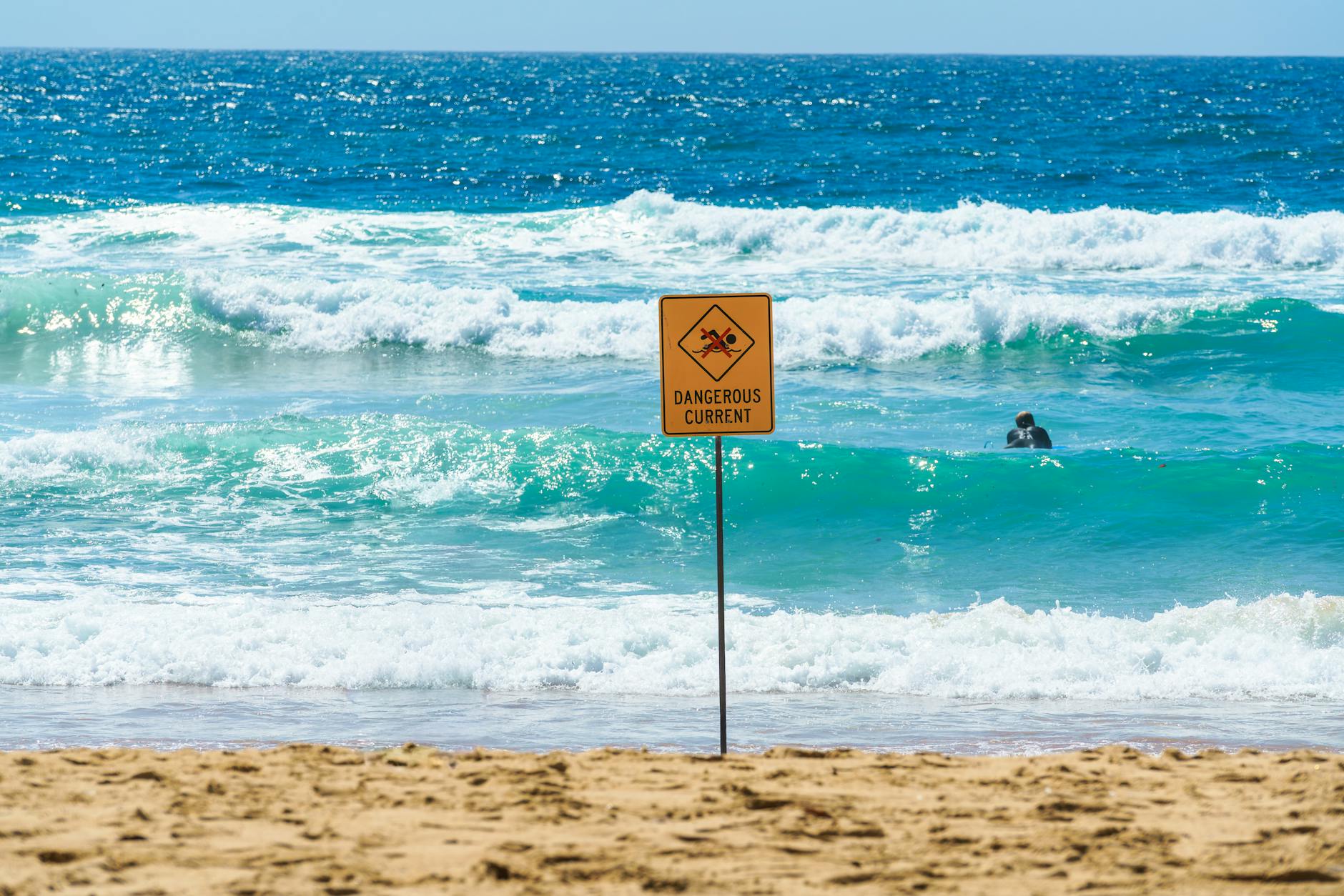
The National Weather Service issued a series of hazard alerts spanning much of Florida on Tuesday, warning beachgoers of dangerous rip currents from Martin County south through Miami-Dade County and cautioning inland residents of Northeast Florida about elevated wildfire conditions driven by critically low humidity and ongoing drought.
The rip current statement from NWS Miami covers coastal Palm Beach, Broward and Miami-Dade counties and is expected to remain in effect through Friday. Palm Beach County faces a high rip current risk through Friday evening, while Broward and Miami-Dade counties carry the same risk through Friday morning. NWS Melbourne extended a separate rip current statement covering beaches of Volusia, Brevard, Indian River, St. Lucie and Martin counties through late Wednesday.
“Rip currents can sweep even the best swimmers away from shore into deeper water,” the NWS warned in both statements, advising residents to swim near a lifeguard and, if caught in a current, to relax, float and swim parallel to the shoreline rather than against the current.
Inland, a different threat is building. NWS Jacksonville issued a special weather statement at 2:24 a.m. Tuesday warning of elevated fire danger across inland Northeast Florida and inland Southeast Georgia. A very dry air mass is producing relative humidity values below 30 percent along and just south of Interstate 10 and below 25 percent west of U.S. Highway 301 in Southeast Georgia, conditions expected to persist for 4 or more hours Tuesday afternoon.
The affected Florida counties include Suwannee, Baker, Union, Gilchrist, Hamilton and Columbia. Light southeast winds of 8-12 mph over inland Northeast Florida, combined with dry fuels from the ongoing drought, are creating conditions ripe for wildfire ignition and spread. Southeast Georgia counties face similar conditions with winds of 4-8 mph.
“Practice Wildfire safety and avoid activities with open flames or sparks,” the NWS Jacksonville statement read. “Obey local burn bans. If you see a wildfire, first walk or drive away from it, then call 911.”
The simultaneous alerts highlight the breadth of weather hazards facing Florida residents this week. The rip current risk stretches across roughly 200 miles of Atlantic coastline from Volusia County south to Miami-Dade County, encompassing some of the state’s most heavily visited beaches. The fire danger zone, meanwhile, covers a swath of rural North Florida where drought conditions have left vegetation increasingly combustible.
The rip current statements from NWS Miami are updates to alerts first issued over the weekend, indicating the hazard has persisted for multiple days. The Palm Beach County statement extends through Friday at 8 p.m., while the Broward and Miami-Dade statement runs through Friday at 8 a.m. The Melbourne statement covering the Treasure Coast and Space Coast beaches expires early Wednesday at 4 a.m.
Residents and visitors along the Southeast Florida coast should monitor conditions through Friday evening, when the current rip current risk period is expected to expire. Inland Northeast Florida residents should remain alert to fire weather conditions through Tuesday at 8 p.m., when the special weather statement is set to end.