Miami faces a building week of rain culminating in a 100% precipitation chance by Tuesday, October 27, while Jacksonville shivers at a statewide-low 55°F Friday, according to National Weather Service data — a contrast that underscores a dramatic split between South Florida’s moisture-laden pattern and the drier, cooler conditions gripping the north.
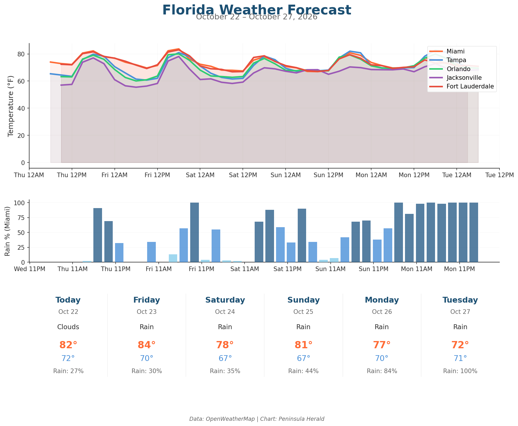
In Miami today, a high of 82°F with 78% humidity and a 27% rain chance gives way to worsening conditions, with Monday bringing 16.9mm of precipitation and an 84% rain chance before Tuesday’s 100% rain chance arrives with a high of only 72°F. Tampa sits at the opposite extreme — a clear 80°F high today, 0% rain chance, and just 61% humidity, with Sunday’s winds gusting to 37 mph marking the week’s roughest stretch on the Gulf Coast. Orlando logs a 79°F high and 63% humidity today under clear skies, with 0% rain chance, though Sunday brings 19 mph sustained winds with gusts to 38 mph. Jacksonville records the coolest low in today’s data at 57°F, with 58% humidity and winds gusting to 16 mph.
By Friday, Jacksonville cools further to a 55°F low while Orlando dips to 60°F under clear skies. Saturday pulls Jacksonville down to a 70°F high with rain arriving and winds at 17 mph, while Tampa holds clear at 78°F with a 9% rain chance. Miami drops to 78°F Saturday with a 35% rain chance and humidity climbing to 81%, then slides to 77°F Monday as Orlando simultaneously peaks at 80°F with gusts reaching 34 mph.