A 30-degree overnight low differential between Miami and Jacksonville defines the most striking weather story across Florida this Saturday, according to National Weather Service data. Miami’s low of 73°F stands in sharp contrast to Jacksonville’s projected Sunday overnight low of 56°F, underscoring the pronounced north-south temperature gradient gripping the state.
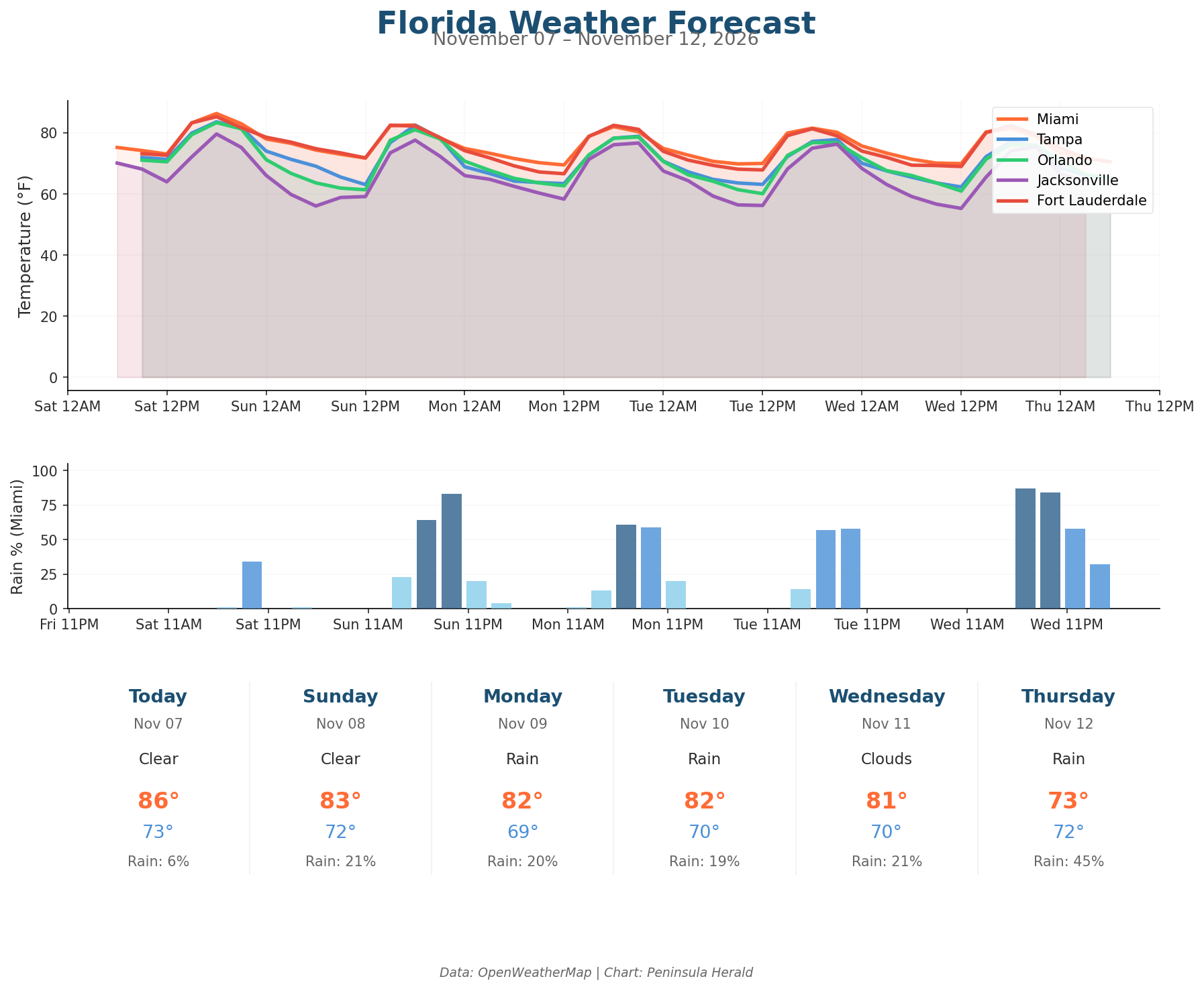
Miami tops today’s highs at 86°F with just a 6% rain chance and humidity at 77%, while winds stay light at 4 mph with gusts reaching 10 mph. Tampa reaches 84°F under clouds with 0% rain chance and the strongest gusts of any city today at 18 mph, humidity sitting at 77%. Orlando climbs to 83°F with 73% humidity, 0% rain chance, and gusts up to 13 mph. Jacksonville, the coolest market today, peaks at 80°F with 70% humidity and a 64°F overnight low, winds gusting to 12 mph.
The three-day trend brings cooling across all four cities. Miami slides from 86°F today to 82°F by Monday, when rain chances climb to 20%, then holds at 82°F Tuesday before dropping sharply to 73°F by Thursday with a 45% rain chance and 94% humidity. Tampa cools steadily from 84°F to 79°F Monday and 77°F Wednesday, bottoming at 68°F Thursday. Orlando drops from 83°F to 77°F Tuesday and 71°F Thursday. Jacksonville’s Sunday low of 56°F marks the coldest reading in the dataset.