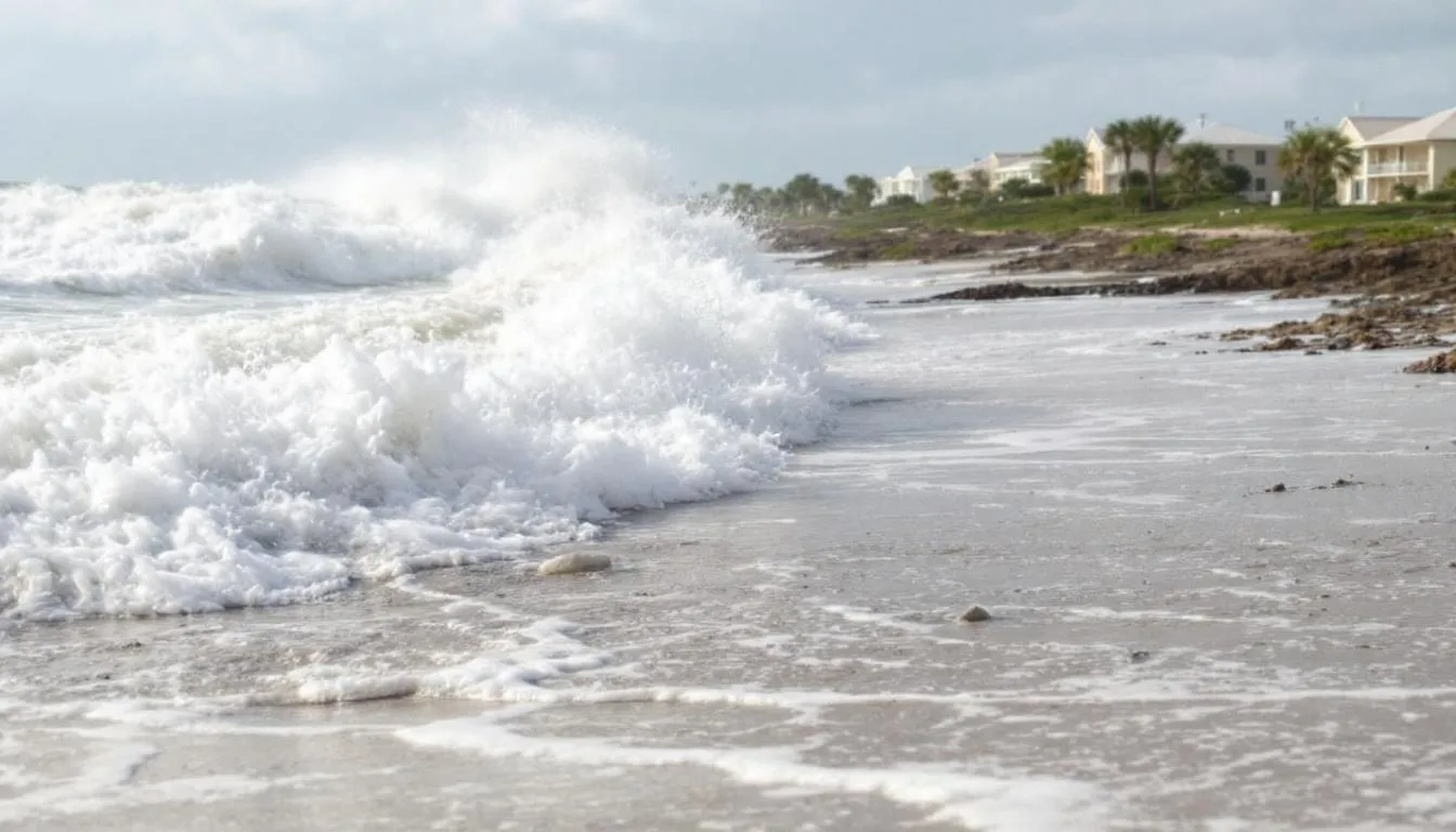
Strong winds are creating hazardous beach conditions along Florida’s coastline, with surf reaching up to 13 feet and a high risk of dangerous rip currents prompting officials to urge residents and spring breakers to stay out of the water. The dangerous conditions are expected to persist through Monday across all coastal communities in Central Florida.
Wave heights offshore are currently measuring between 8 to 10 feet, with some areas seeing waves as high as 13 feet. Red flags are flying at beaches including New Smyrna Beach, where wind gusts have reached the 30-mile-per-hour range. A gale warning remains in place as offshore seas could reach anywhere between 9 and 14 feet through the weekend.
The warning comes as Florida leads the nation in rip current fatalities, accounting for a significant portion of drowning deaths. Last year, out of the 47 rip current fatalities across the United States, Florida had 25 of those deaths. Out of the four rip current fatalities seen so far in 2026, one has already occurred in Florida.
Peak wind gusts recorded include 39 miles per hour in Leesburg, while coastal areas including Palm Coast, Daytona Beach and New Smyrna Beach have experienced wind gusts in the 30-mile-per-hour range. A wind advisory remains in effect for most counties in Central Florida, especially along the coast. The strong gusty winds are the result of a cold front with a tight pressure gradient, which increases wave heights and creates dangerous surf conditions.
Current temperatures across Central Florida are showing 70 degrees in New Smyrna Beach, with other areas in the low 70s and upper 60s. Orlando International Airport recorded sustained winds at 24 miles per hour with gusts reaching 33 miles per hour. The cold front is expected to stall out across southern Florida, but breezy conditions will continue into Sunday morning with 34-mile-per-hour gusts expected at New Smyrna Beach.
Isolated showers have been reported across eastern Marion County, with heavy showers affecting the Clermont Disney tourist district. Rain bands are moving in from the east coast sea breeze, affecting areas west of Interstate 95 including Port Saint John, Melbourne, Palm Bay and Satellite Beach. Fast-moving bands of rain are moving onshore across Cape Canaveral and the Titusville area.
The high rip current risk will continue across Monday for all coastal communities in Central Florida. Wave heights are expected to slowly decrease throughout the work week, with 6 to 10-foot conditions still expected on Monday. Temperatures will drop into the mid-60s overnight before warming into the low to mid-80s by mid to late week, with onshore winds keeping periodic coastal showers possible.