Jacksonville is forecast to reach 101°F on Saturday, July 25, the highest temperature recorded across any Florida city in the current forecast period, according to National Weather Service data. Miami, by contrast, faces an 87% rain chance by Tuesday, July 28 — the steepest precipitation probability in the dataset — creating a 14-degree spread between the state’s hottest and wettest stories this week.
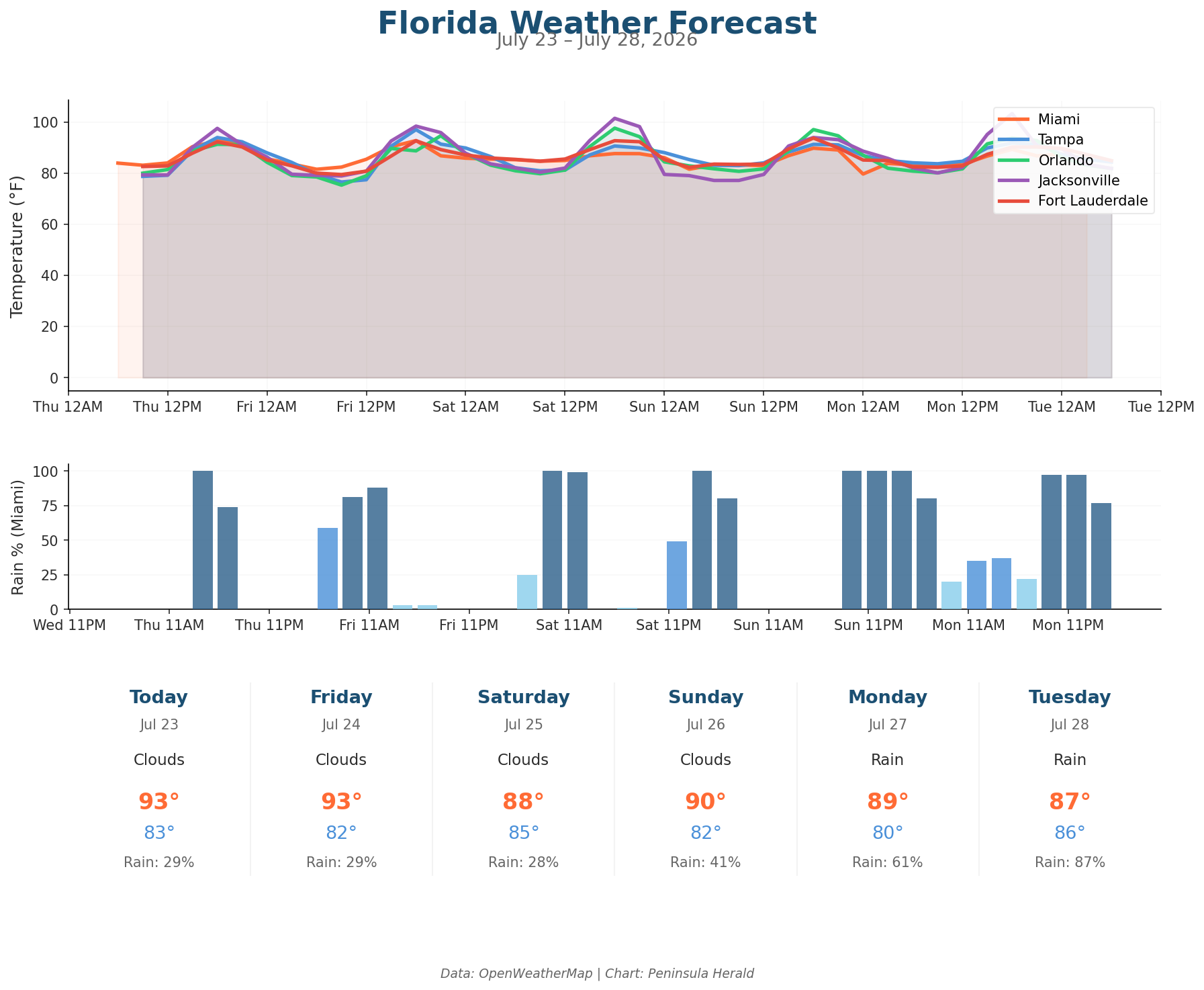
Today, Jacksonville leads the state with a 98°F high and only a 5% rain chance, while Tampa reaches 94°F under clear skies with winds barely touching 6 mph and a 4% rain chance. Orlando sits at 91°F with 0% rain chance and 56% humidity. Miami tops out at 93°F with a 29% rain chance and winds gusting to 16 mph, carrying 69% humidity. Tampa’s low of 79°F gives it the widest single-day temperature swing at 15 degrees.
Tampa surges to 97°F on Friday before pulling back to 91°F Saturday. Orlando climbs to 95°F Friday, then peaks at 98°F Saturday before rain chances jump to 36% Sunday and 45% Monday. Jacksonville holds at 98°F Friday before hitting 101°F Saturday with only a 4% rain chance. Miami’s rain chance escalates from 29% Friday to 41% Sunday, then 61% Monday, reaching 87% Tuesday with a high of 87°F.