Jacksonville faces the most extreme weather conditions across Florida this week, with temperatures forecast to reach 101°F by Wednesday and a 36% rain chance Tuesday bringing an estimated 10.8mm of precipitation, according to National Weather Service data. The 26-degree spread between Jacksonville’s 75°F overnight low and its Tuesday high of 100°F marks the widest temperature range in the state Monday.
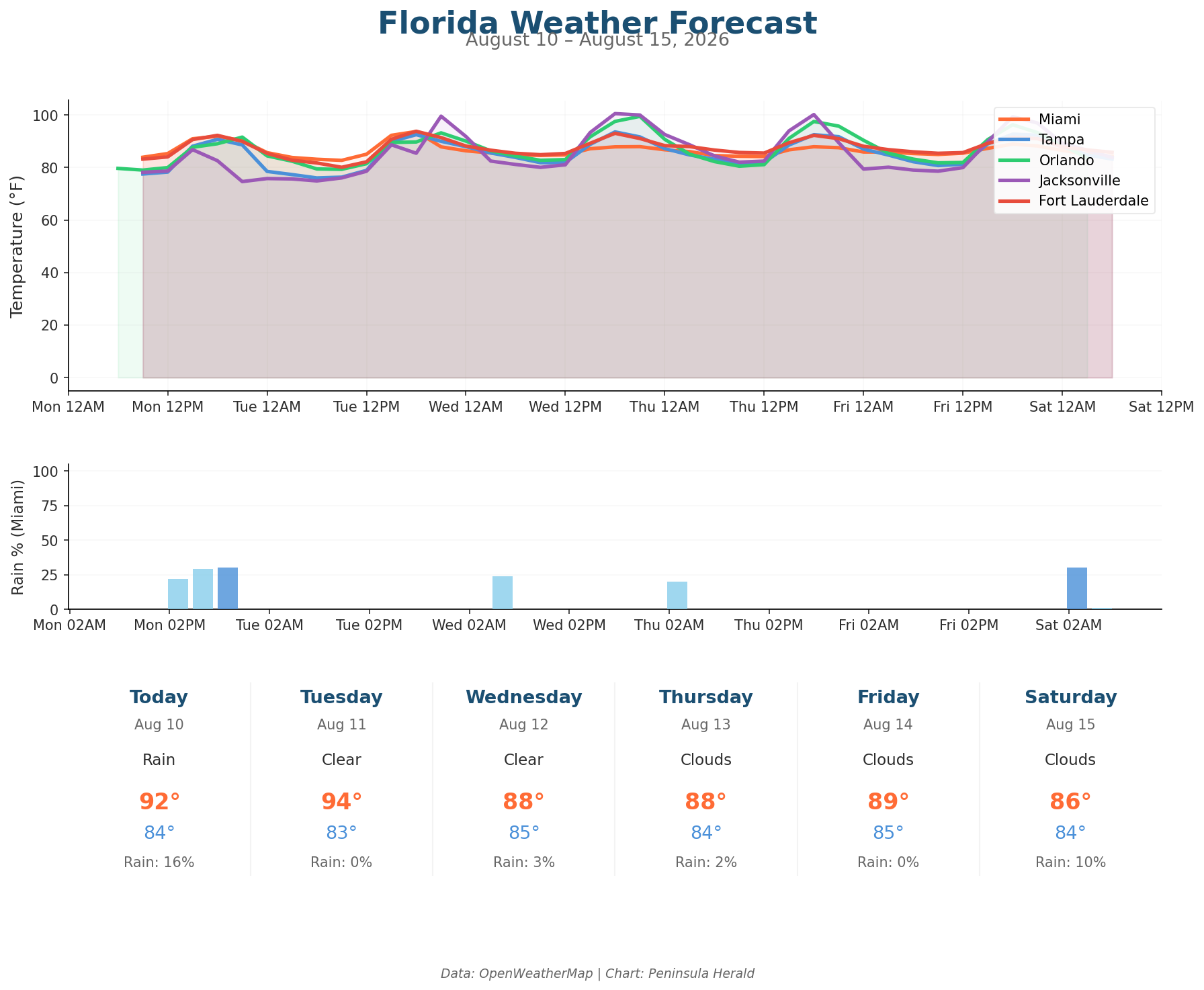
Jacksonville tops today’s readings with an 87°F high, 75°F low, 68% humidity, winds up to 6 mph with 11 mph gusts, and a 28% rain chance. Miami reaches 92°F with a 84°F low, 69% humidity, 13 mph winds gusting to 15 mph, and a 16% rain chance with 0.7mm of precipitation expected. Orlando matches Miami’s 92°F high but carries a 13% rain chance, 79°F low, and light winds of 7 mph gusting to 16 mph. Tampa sits at 91°F with the lowest rain chance of the four cities at 0%, a 78°F low, and 67% humidity with gusts reaching 17 mph.
Orlando’s three-day trend is the most dramatic in the state, climbing from 92°F Monday to 99°F Wednesday before pulling back to 98°F Thursday. Tampa warms from 91°F Monday to 94°F Wednesday, then holds at 92°F Thursday. Miami dips from 92°F Monday to 88°F Wednesday. Jacksonville sustains its heat surge at 101°F Wednesday before Orlando closes the week with a 34% rain chance and 89°F high Saturday.