Jacksonville is forecast to reach 103°F on Tuesday, the highest temperature recorded across any Florida city this week, according to National Weather Service data — a 26-degree spread above Miami’s 77°F overnight low that marks the widest single-day temperature range in the current forecast period.
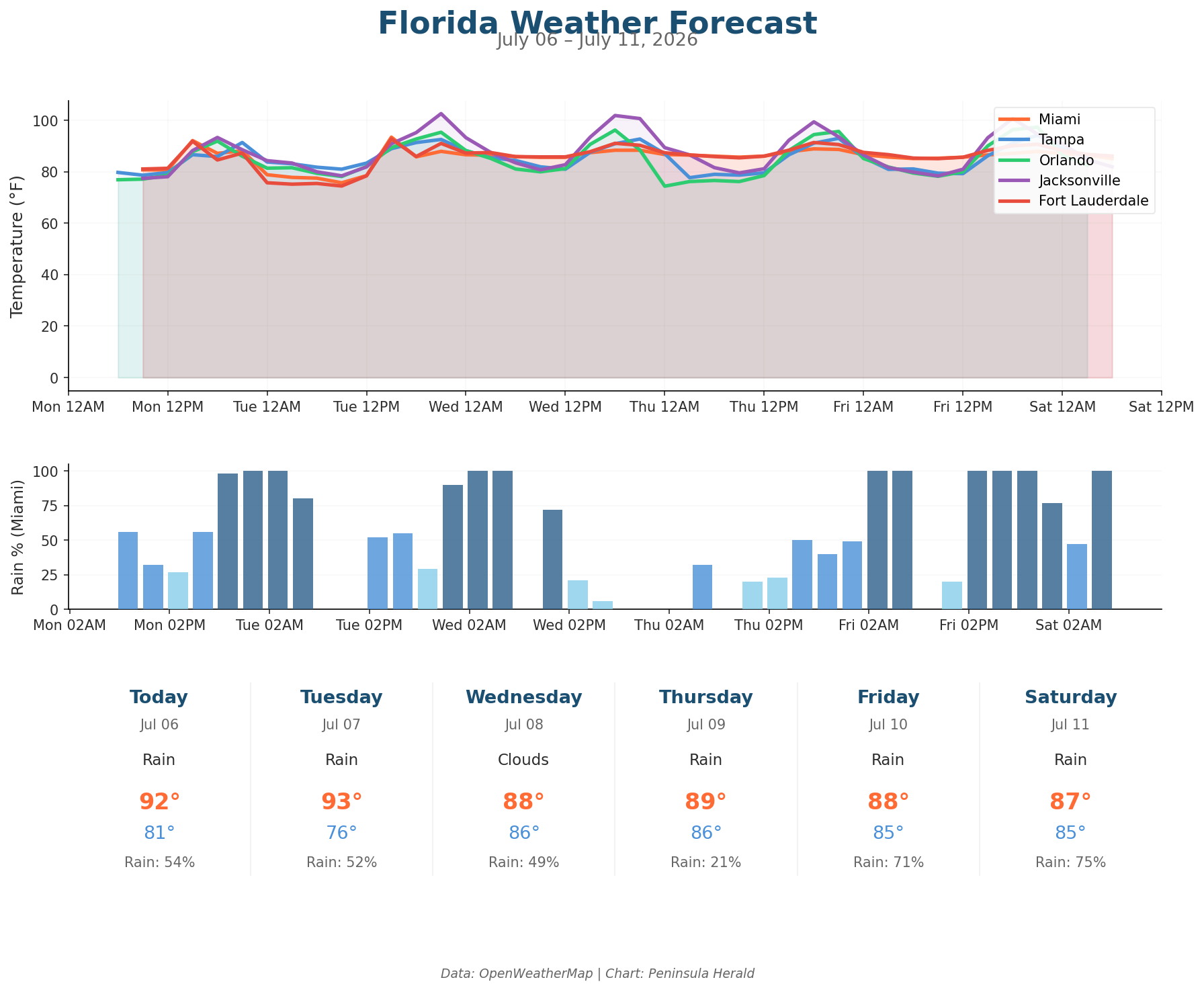
In Jacksonville today, a high of 93°F with only a 9% rain chance and humidity at 57% gives way to Tuesday’s punishing 103°F under cloudy skies with winds gusting to 17 mph. Orlando reaches 92°F today with a modest 16% rain chance before climbing to 95°F Tuesday and 96°F Wednesday, when rain chances jump to 55%. Miami sits at 92°F today with a 54% rain chance and 1.8mm of precipitation, while Tampa tops out at 91°F under clouds with a 42% rain chance and winds at 10 mph.
Jacksonville holds at 102°F Wednesday before data cuts off. Orlando surges to 97°F Friday with only an 8% rain chance, then drops sharply to 86°F Saturday as rain chances spike to 80%. Miami’s Friday brings 88°F with a 71% rain chance and 12.4mm of precipitation. Tampa peaks at 94°F Friday with gusts reaching 21 mph, then eases to 89°F Saturday with humidity falling to 60%.