Jacksonville is forecast to reach 103°F on Tuesday, August 18, the highest temperature in the National Weather Service data for any Florida city this week, according to National Weather Service data. Orlando is close behind, projected to hit 100°F on Wednesday, August 19, creating a multi-city heat event across northeast and central Florida.
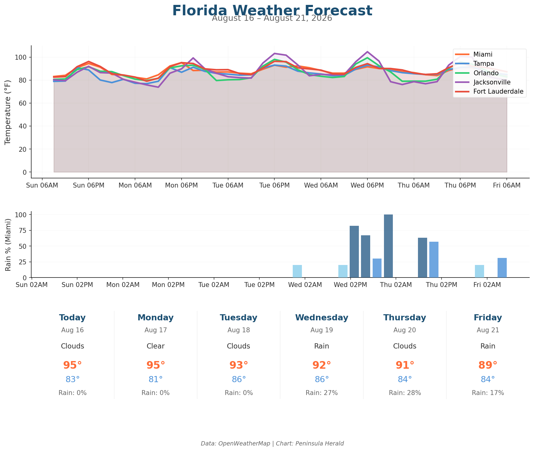
Today, Miami leads with a high of 95°F and 0% rain chance under cloudy skies with humidity at 67%. Tampa sits at 91°F with a 28% rain chance and winds up to 10 mph. Orlando reaches 92°F today with a 35% rain chance and 1.2mm of precipitation expected. Jacksonville tops out at 92°F today with 0% rain chance and the lowest humidity of the four cities at 55%.
The three-day trend shows intensifying heat inland. Jacksonville climbs from 92°F today to 99°F Monday with a 39% rain chance, then surges to 103°F Tuesday. Orlando rises to 98°F Tuesday before peaking at 100°F Wednesday with a 34% rain chance and 3.5mm of precipitation. Tampa’s most significant rain arrives Wednesday at a 59% chance with 10.0mm of precipitation, while Miami’s first rain of the week arrives Wednesday at 27% with 1.4mm.