Jacksonville is forecast to reach a scorching 104°F on Wednesday, the highest temperature in the current forecast period across all monitored Florida cities, according to National Weather Service data. That same day, Tampa faces a 41% rain chance with 2.8mm of precipitation expected, creating a stark contrast between North Florida’s heat and the Gulf Coast’s storm risk.
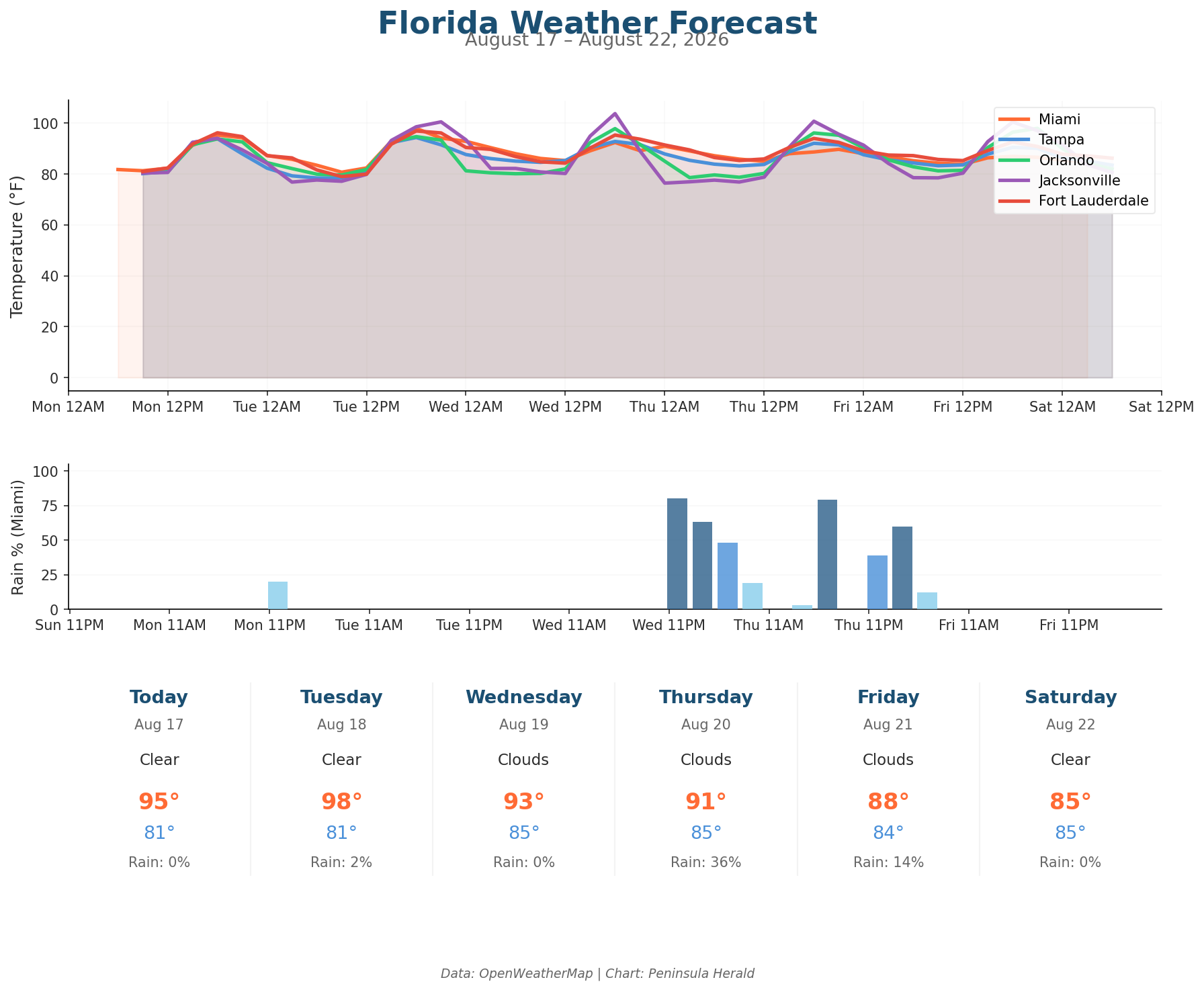
In Miami today, a high of 95°F with 0% rain chance and 66% humidity accompanies winds up to 18 mph. Tampa reaches 94°F under cloudy skies with 61% humidity and 13 mph winds. Orlando also hits 94°F today with just 8 mph winds and 0% rain chance. Jacksonville matches that 94°F high but with gusts reaching 17 mph and only 56% humidity. Tuesday brings Jacksonville to 100°F with 23 mph gusts and 54% humidity, while Orlando climbs to 95°F with a 27% rain chance and 1.1mm of precipitation.
Wednesday’s 104°F in Jacksonville contrasts with Orlando’s 98°F high carrying a 38% rain chance and 6.6mm of precipitation. By Thursday, Orlando’s rain chance rises to 39% with 10.5mm projected — the heaviest single-day precipitation total in the dataset — while Miami edges toward a 36% rain chance with 2.8mm. Tampa cools slightly to 92°F Thursday with a 23% rain chance. Miami drops further to 88°F by Friday with only a 14% rain chance, and Orlando rebounds to 98°F under cloudy skies with 0% rain.