Miami’s 91°F high Tuesday stands as the most extreme reading across the state, while a 73% rain chance arriving by Sunday signals a significant late-week deterioration for South Florida, according to National Weather Service data. The 17°F spread between Miami’s 91°F peak and Tampa’s 66°F overnight low marks the sharpest temperature contrast statewide today.
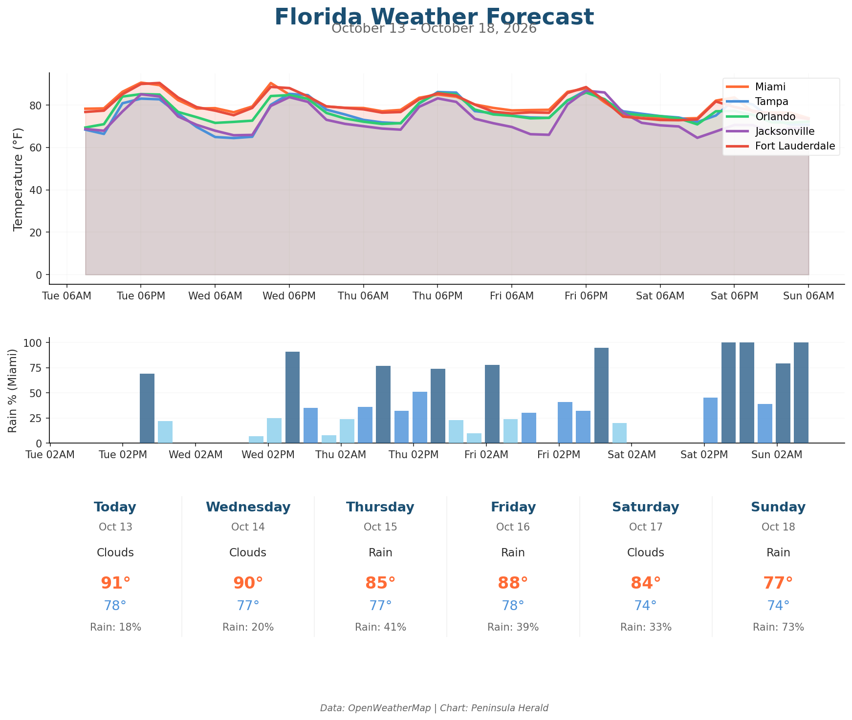
Miami reaches 91°F with gusts to 17 mph, 70% humidity, and an 18% rain chance. Tampa sits at 83°F under clear skies with 0% rain chance and gusts reaching 12 mph. Orlando tops out at 85°F with 75% humidity and 0% precipitation chance, while winds gust to 13 mph. Jacksonville matches Orlando’s 85°F high under clear skies, with 72% humidity and gusts to 14 mph.
Miami cools to 85°F by Thursday as rain chances climb to 41%, then drops further to 84°F Saturday with 33% rain chance before Sunday’s 77°F high arrives alongside that 73% rain chance. Tampa bucks the trend, warming to 87°F Friday before dropping sharply to 74°F Sunday. Orlando slides from 86°F Friday to 72°F by Sunday, while Saturday brings Orlando’s strongest gusts at 27 mph. Tampa’s Saturday gusts reach 26 mph as humidity there climbs to 84%.