Orlando is forecast to reach 100°F by Wednesday, the highest temperature recorded across any Florida city in this forecast period, according to National Weather Service data. That marks a 5-degree jump from Orlando’s Monday high of 95°F and stands 11 degrees above Miami’s projected 89°F Wednesday high.
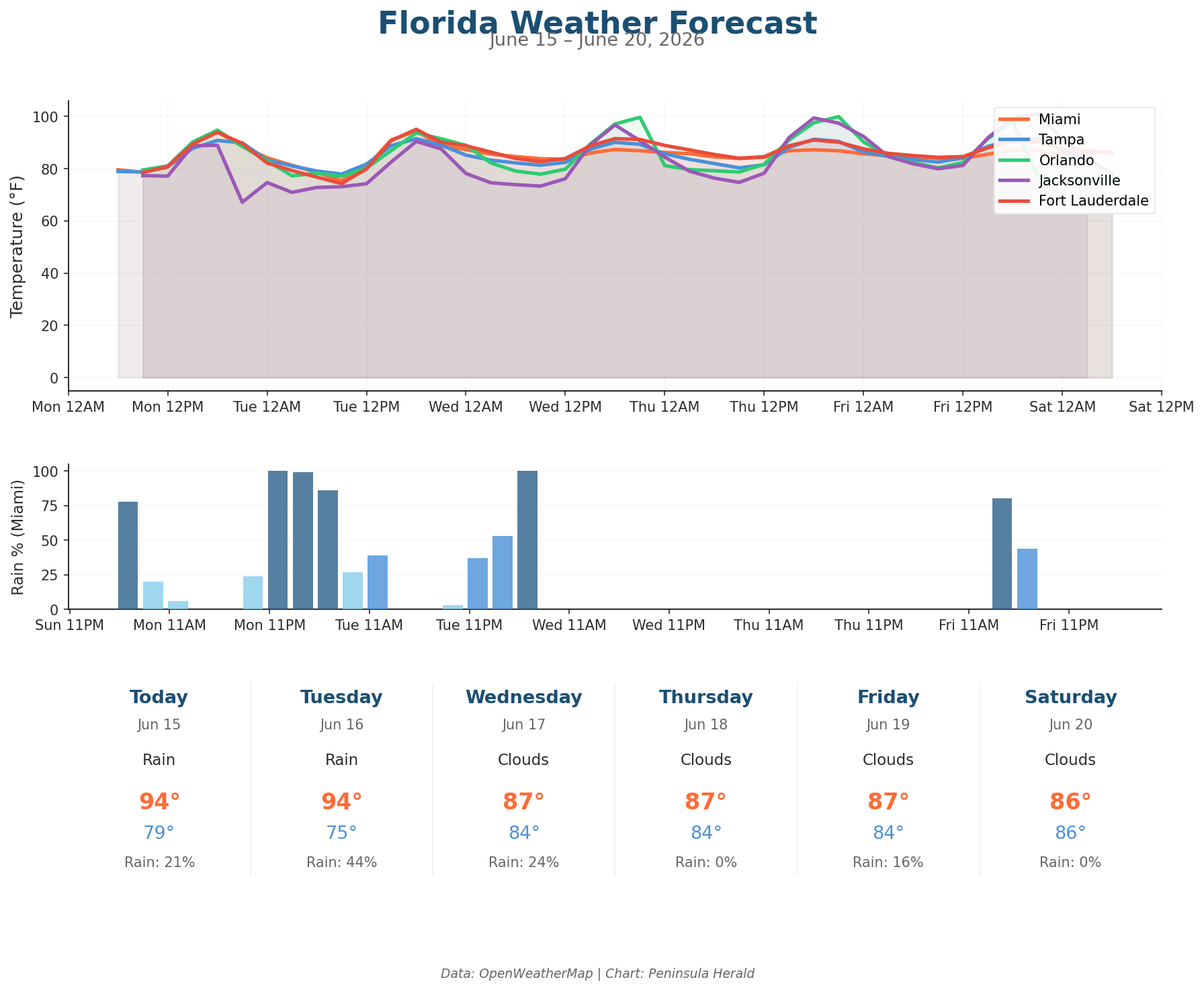
Orlando leads all cities today at 95°F with a 14% rain chance and winds gusting to 14 mph. Miami hits 94°F with a 21% rain chance and gusts reaching 17 mph, with 0.9mm of precipitation expected. Tampa reaches 91°F under cloudy skies with 0% rain chance and 14 mph winds. Jacksonville tops out at 89°F with the highest Monday rain probability at 33%, 4.2mm of precipitation, and gusts spiking to 22 mph. Orlando’s low tonight drops to 79°F, matching Miami’s 79°F low, while Jacksonville falls to 67°F — the coolest overnight reading statewide.
Orlando holds at 100°F Thursday before pulling back to 98°F Friday, when a 42% rain chance and 7.9mm of precipitation arrive. By Saturday, Orlando crashes to 77°F with an 85% rain chance and 6.4mm of precipitation. Jacksonville climbs to 97°F Wednesday before Tuesday delivers 12.3mm of precipitation at a 37% rain chance. Miami’s rain probability jumps to 44% Tuesday before easing to a 24% chance Wednesday at 87°F. Tampa remains dry through Friday before a 38% rain chance arrives Saturday at 87°F.