Orlando’s forecast high of 96°F on Wednesday, August 26 marks the most extreme temperature reading across the state this week, while Miami carries a 44% rain chance today with 3.2mm of precipitation expected, according to National Weather Service data. Tampa sits at just a 10% rain chance Monday despite a 90°F high, creating a 34-percentage-point spread in rain probability between the two Gulf Coast neighbors.
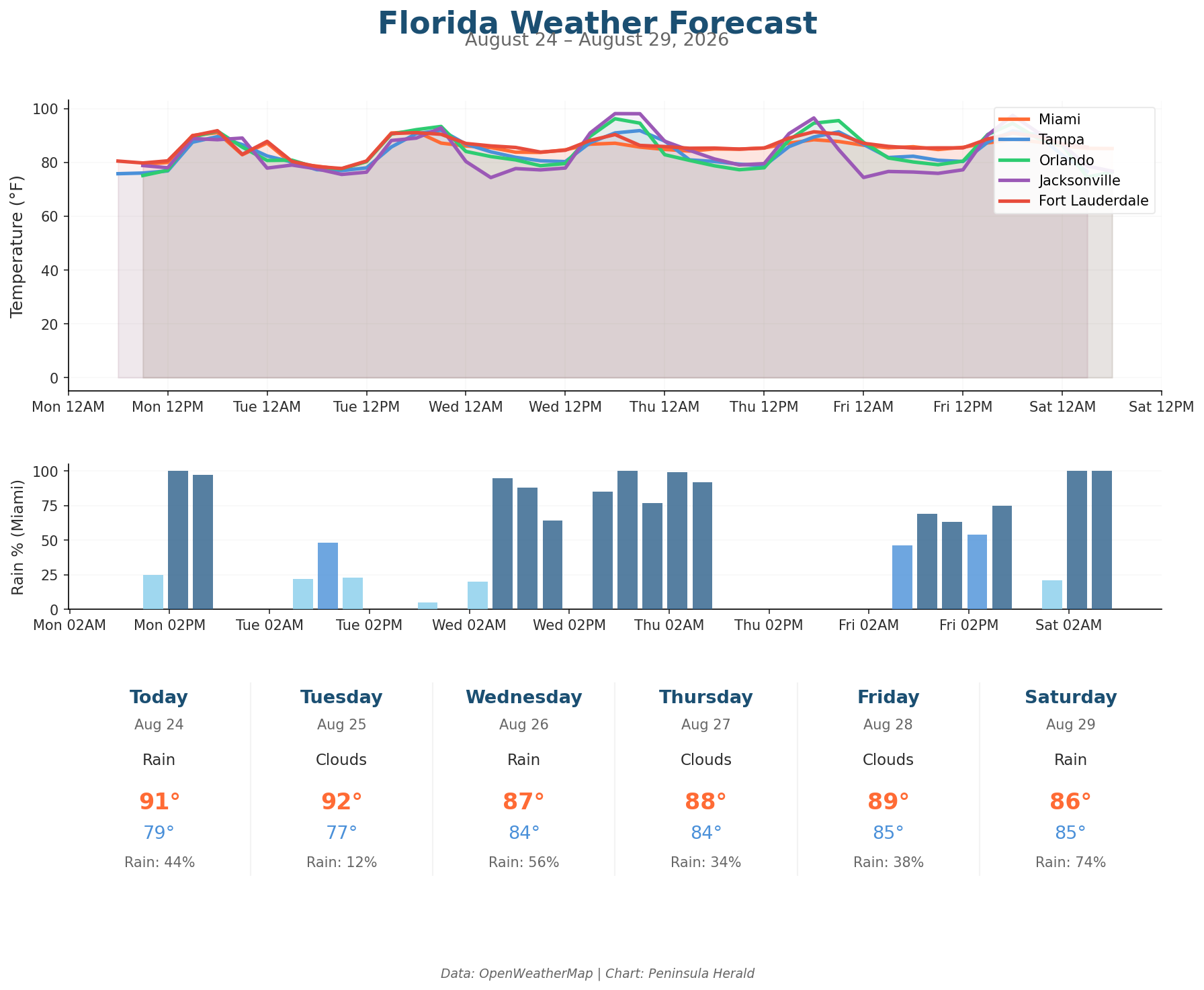
Orlando leads all cities today with a 92°F high and a dry 0% rain chance at 58% humidity, with winds reaching 10 mph. Jacksonville reaches 89°F with only a 4% rain chance and the lowest humidity of the group at 55%, gusting to 12 mph. Miami’s 91°F high comes with a 79°F overnight low and 65% humidity. Tampa’s 76°F low is the coolest overnight reading Monday, with winds holding at 10 mph and just 0.7mm of precipitation possible.
Orlando climbs to 93°F Tuesday before surging to 96°F Wednesday, where it holds through Thursday. Jacksonville jumps to 93°F Tuesday then rockets to 98°F Wednesday. Miami cools from 92°F Tuesday to 87°F Wednesday as its rain chance spikes to 56% with 7.3mm of precipitation. Tampa remains dry at 92°F Wednesday before a Saturday collapse to 83°F brings a 100% rain chance and 7.7mm of rain. Orlando drops sharply to 86°F Saturday with a 90% rain chance.