Orlando is forecast to reach 99°F on Tuesday, the highest temperature recorded across any Florida city in this forecast cycle, according to National Weather Service data — a 9-degree spike from Monday’s high of 90°F that underscores a sharp mid-week heat buildup across the peninsula.
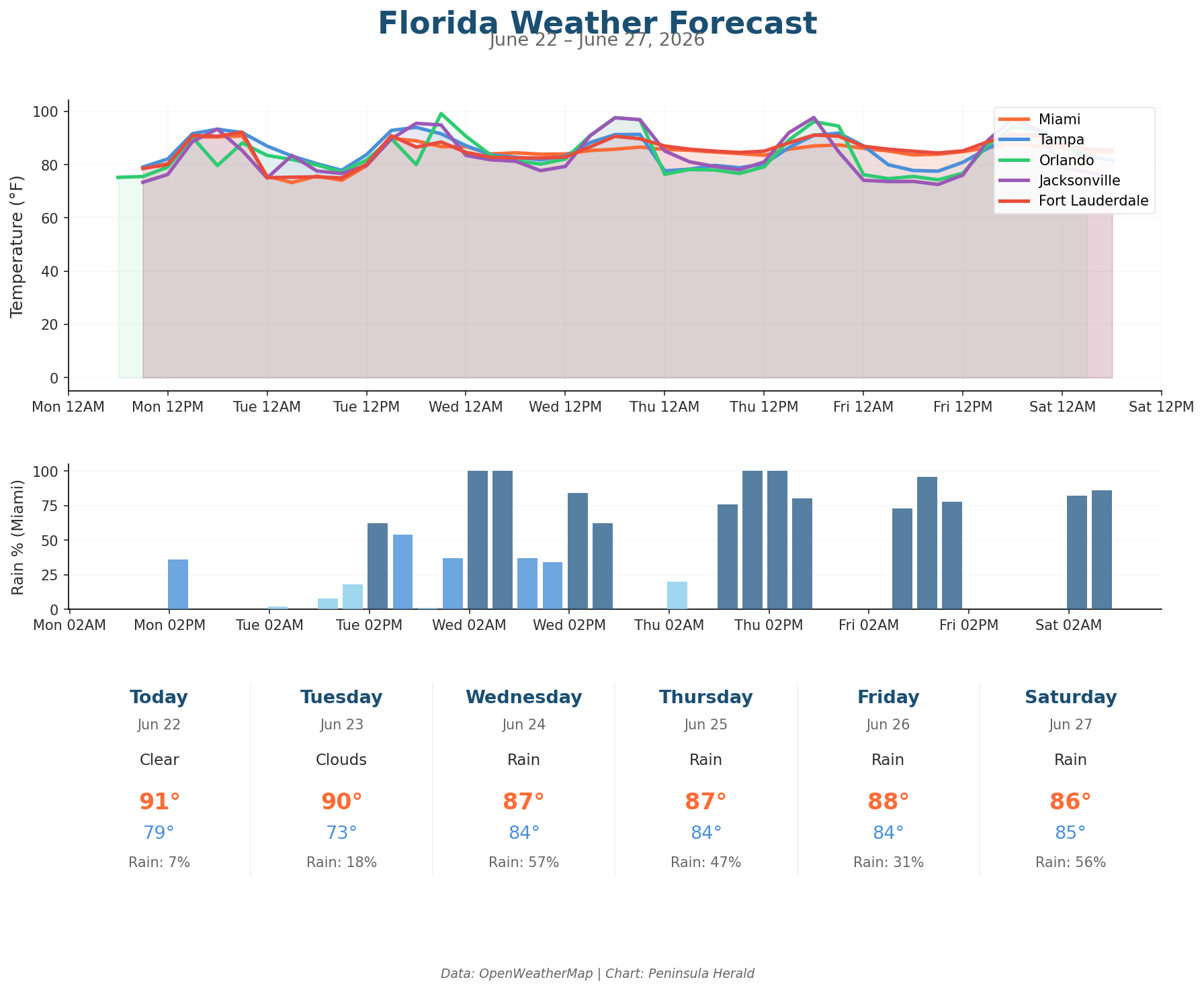
Today, Tampa leads all cities with a 93°F high and 0% rain chance, while Jacksonville reaches 93°F under cloudy skies with 62% humidity and winds gusting to 14 mph. Orlando hits 90°F with just a 3% rain chance and light winds of 7 mph. Miami posts a 91°F high with 66% humidity, winds up to 11 mph, and only a 7% chance of rain.
By Tuesday, Jacksonville climbs to 96°F with gusts reaching 20 mph, while Tampa holds at 94°F under clear skies and 57% humidity. Wednesday brings the first significant rain threat: Miami’s rain chance jumps to 57% with a high of 87°F, and Tampa sees clouds build with an 18% rain chance and winds increasing to 19 mph. Jacksonville reaches 98°F Wednesday with humidity dropping to 53%. By Thursday, Tampa’s rain chance surges to 58% with 6.7mm of projected precipitation, and Orlando’s Thursday forecast carries 14.8mm of precipitation at a 37% rain chance with a 96°F high.