Orlando is on track to reach 99°F by Tuesday, August 11, marking the most extreme temperature in the current forecast period, according to National Weather Service data. Miami carries the highest rain chance today at 55%, with 3.2mm of precipitation expected, while Jacksonville faces a 48% rain chance and 3.5mm of rainfall Saturday.
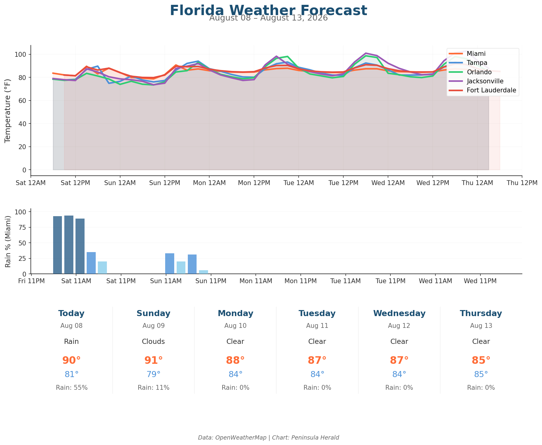
In Miami, today’s high reaches 90°F with a low of 81°F, winds up to 13 mph gusting to 16 mph, and humidity at 71%. Tampa hits 90°F today with a low of 75°F, 39% rain chance, and gusts reaching 17 mph at 75% humidity. Orlando tops out at only 83°F Saturday — its coolest day in the forecast window — with an 18% rain chance and gusts up to 20 mph. Jacksonville reaches 87°F today under rainy skies with winds gusting to 16 mph and humidity at 71%.
The three-day trend shows a sharp warming pattern inland. Orlando climbs from 83°F Saturday to 93°F Sunday, then surges to 98°F Monday before peaking at 99°F Tuesday. Tampa jumps to 94°F Sunday, then holds at 93°F Monday and 92°F Tuesday. Miami’s rain chance collapses from 55% Saturday to just 11% Sunday, then drops to 0% Monday. Jacksonville’s Sunday rain chance remains elevated at 44% before conditions shift Monday, where the city is forecast to reach 98°F.